- Major Projects
- A Border Peepshow
- Air Quality Monitor & Weather Station
- Electric Shadows on Penglai Mountain
- Film-In-Residence
- Grand Moving Mirror of California Test Project
- In a Time & Place
- Nancy Columbia & The Arctic Beyond
- Pursuing the Verdant Dream
- Test Project
- The Future is a Well-Traveled Track
- The Painted Cinema of Karel Zeman
- Union Square Florist Shop
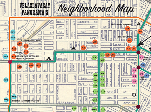
- Velaslavasay Panorama's Neighborhood Map
- Voyage To The Land Of Speaking Blood
- Multilingual Brochure
- Press
- Former Hollywood Location
- Home
- On View
- Events
- About
- Major Projects
- A Border Peepshow
- Air Quality Monitor & Weather Station
- Electric Shadows on Penglai Mountain
- Film-In-Residence
- Grand Moving Mirror of California Test Project
- In a Time & Place
- Nancy Columbia & The Arctic Beyond
- Pursuing the Verdant Dream
- Test Project
- The Future is a Well-Traveled Track
- The Painted Cinema of Karel Zeman
- Union Square Florist Shop
- Velaslavasay Panorama's Neighborhood Map
- Voyage To The Land Of Speaking Blood
- Multilingual Brochure
- Press
- Former Hollywood Location
- Major Projects
- History
- Support
- Gift Shop
